Water · Entry 01
The Qanat
A tunnel driven uphill from the far end, following a slope almost too gentle to see, moving water tens of kilometres without a pump and losing almost none of it.
The logic of the slope
The Iranian plateau sits mostly above one thousand metres, and much of it receives less than 250 millimetres of rain a year. The mountains that ring the plateau catch snow and store it, but the villages and fields are far out on the flat. The problem is not that water does not exist — it does, held in gravel aquifers below the alluvial fans at the base of the ranges — but that it cannot stay on the surface long enough to do any good. Evaporation on the plateau is savage. A surface channel loses water steadily to sun and air, and the gradients needed to make water travel far would also make it move too fast, eroding its bed and arriving silty and hard to control.
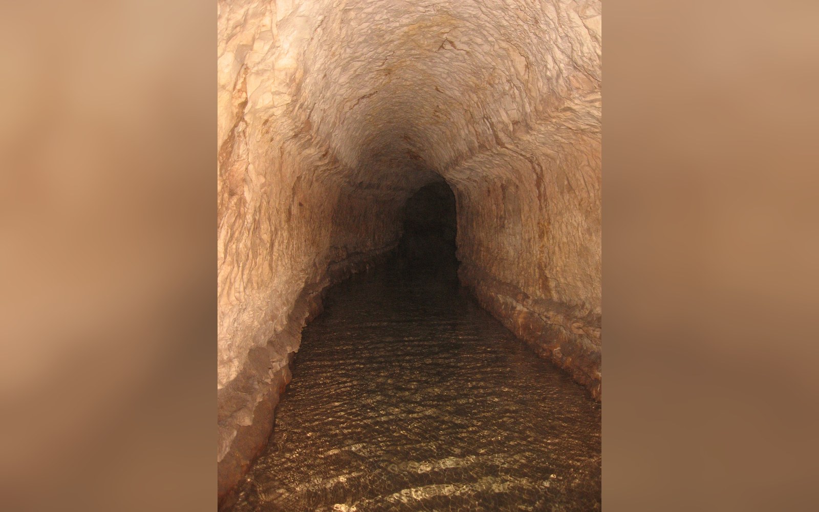
The qanat answers every part of this problem at once. It is a gently sloping tunnel, hand-dug through the earth, that runs from a shaft sunk into the aquifer near the mountains all the way to the fields or settlement it serves, sometimes ten, twenty, thirty kilometres away. The tunnel stays below ground for almost its entire length, so evaporation is negligible. The gradient is calibrated — typically between one in one thousand and one in fifteen hundred — so water flows by gravity alone, at a steady rate, without scouring the channel floor. When the tunnel finally emerges into daylight at the village end, the water has already arrived at the point where it is needed. No pump, no wheel, no engine, no lifting — only a slope and patience.
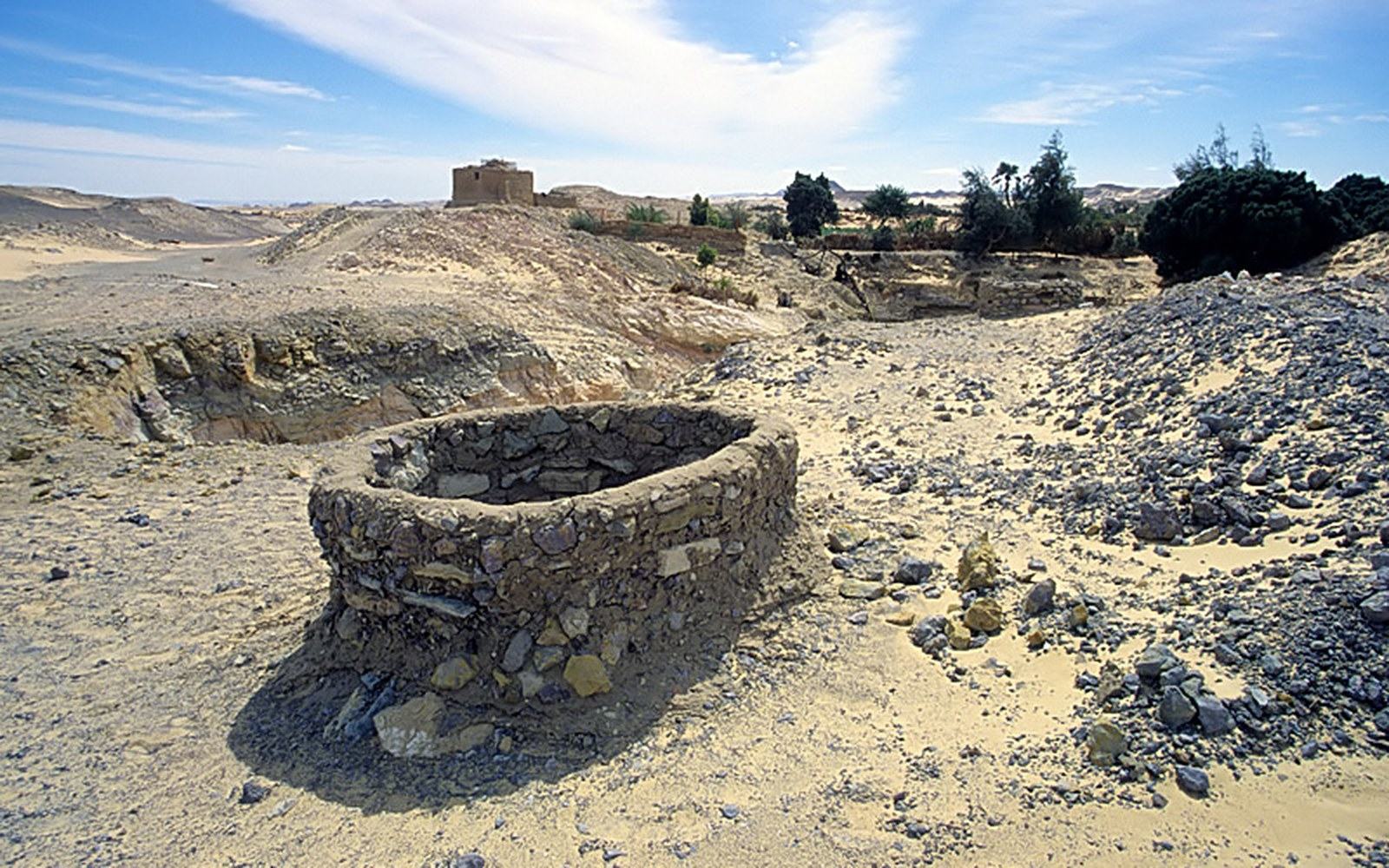
What makes this engineering rather than luck is how the slope is established. The muqanni — the specialist digger, a hereditary craft in most of the regions where qanats were built — works from a series of vertical shafts sunk at intervals along the projected route, each shaft used both for excavation and ventilation. These shafts, spaced between fifty and one hundred metres apart across a long route, leave the surface marked by a line of low spoil rings that from the air looks like stitching on pale cloth, and the visual signature of a living qanat landscape is unmistakable. The muqanni descends into each shaft in turn, cuts a measured length of horizontal tunnel toward the last completed section, and checks alignment and gradient with a plumb line and a simple water level — a string of thread and a clay lamp, in the oldest practice. The tunnel advances section by section from the surface opening toward the mother well, always cutting slightly uphill toward the water-bearing ground.
The Mother Well and the tunnel
The deepest shaft at the mountain end is called the mādar chāh, the mother well. Its depth determines everything: how high into the aquifer the tunnel can reach, and therefore how much water the system captures. A mother well in the Yazd basin might be forty metres deep; on the alluvial fans below the Alborz it can go considerably deeper. The tunnel cross-section is just large enough for the muqanni to work in — roughly a metre wide and perhaps 1.2 to 1.5 metres high — because a larger tunnel means far more labour per metre of advance, and the qanat's economic logic depends on minimising excavated volume while maximising delivered water.
The tunnel floor is not flat. It is graded with exceptional care, because a gradient even slightly too steep cuts into the soft alluvium, raising sediment that clogs the channel and reduces flow; a gradient too gentle lets fine material settle and also reduces flow. The ideal is water that moves just fast enough to keep the floor clean but not fast enough to erode it. Maintaining this over decades requires regular cleaning expeditions, and the water shares system that governs how a qanat's flow is apportioned among users also typically obligates those users to fund and carry out maintenance — the two are structurally linked.
What makes this engineering rather than luck is how the slope is established.
The material excavated from each shaft and from the tunnel sections is lifted out in leather buckets on a hand-operated windlass and piled at the shaft mouth, forming the spoil rings visible from above. Nothing is wasted: the excavated earth, if it contains usable clay, goes to make adobe; the tunnel walls in many qanats are lined with fired brick or fitted stone at the vulnerable junctions where a shaft meets the horizontal run, though much of the tunnel travels through alluvium cohesive enough to need no lining at all.
How much water, and for how long
A productive qanat in a well-watered catchment can deliver several hundred litres per second. More typical flows in the Yazd and Kerman regions, where the geology is less generous, run between ten and fifty litres per second — enough to sustain a village and its surrounding fields, to fill the ab anbar cisterns that buffer supply against the dry season, and to feed the garden channels without which settlement on the plateau is unsustainable. What a qanat cannot do is be turned up or down to match demand: it flows at whatever rate the aquifer gives, continuously, day and night, whether anyone is drawing from it or not. This is why the time-based water-share schedule is not a convenience but a necessity — water is caught and used in allocated periods rather than drawn on demand.
The depth of the mother well also sets a limit. As regional groundwater levels fall, whether from drought or from competing extraction, the mother well begins to pull air rather than water and the qanat fails. Historical abandonment of qanat systems, across the plateau, almost always traces to one of three causes: aquifer depletion, the destruction of the upper catchment works during a period of disorder, or the arrival of mechanically pumped wells that drew down the water table faster than seasonal recharge could replace it. A qanat running dry is not a failed design — it is a sign that the aquifer it was reading has been overdrawn.
The oldest identified qanat systems in Iran date to at least the first millennium BCE; some accounts reference systems possibly older, though secure dating is difficult. What is clear is that the technology spread: to the Maghreb, to the Arabian Peninsula, to the Iberian peninsula, with the names falaj (Arabian Peninsula) and foggara (Maghreb) used elsewhere, and to parts of the Americas after the Spanish encounter. The spread itself testifies to the design's fitness — it solves a real physical problem with minimal materials, builds in redundancy through its modular shaft structure, and requires only the kind of ongoing human attention that communities with a stake in the outcome are naturally motivated to provide.
The qanat is, in the end, a long conversation between a muqanni's measurements and the physics of an aquifer: a system that works only if it listens accurately to what the ground is actually doing, and cuts accordingly.